Refer to previously collected locations in a survey
Previously collected locations such as a geopoint, geoshape or geotrace can be referenced during a survey just like any other previously collected data. There several ways this can be done.
Locations in a repeat
Add the appearance history-map to a location question inside a repeat. For FieldTask you will also need to add an appearance of placement-map so that the map is shown.
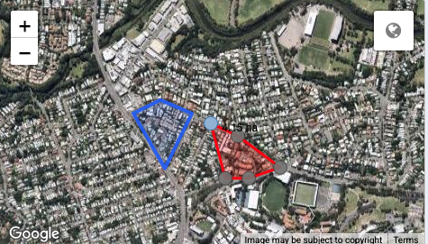
Appearance history-map in WebForms on a geoshape question - one previous location shown in blue (Requires Smap Server 16.06+)
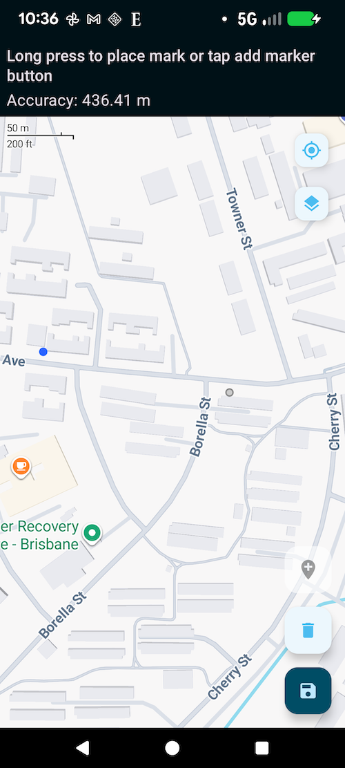
Appearance history-map in FieldTask on a geopoint question - one previous location shown in blue
Get a previous recorded location using pulldata
The pulldata function can reference location data form a CSV file or another survey to use in a form. In this example the previously recorded boundaries of a farm can be downloaded for editing.
type |
name |
label |
calculation |
|---|---|---|---|
text |
name |
Farm Name |
|
geoshape |
boundary |
Record the boundary |
pulldata('linked_self', 'boundary', 'name', ${name}) |